Tracks and trails

Hobart boasts of an extensive network of tracks and trails that cater to the interests of hikers, runners and mountain bikers.
The city's trails range from easily accessible, well-maintained paths, to challenging rugged terrain. Visitors are sure to find a trail that suits their interests and abilities.
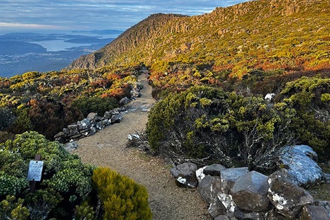
These tracks and trails provide a unique opportunity to explore Hobart's natural beauty, and offer breathtaking views of the city and its surrounding landscape.
The City of Hobart provides comprehensive maps of its bushland tracks for walking, dog walking, and bike riding:
Bushland track maps
Please note: the map is best viewed on a desktop device.
About shared use tracks
A lot of our bushland tracks are Shared Use. This means they're built to be used by walkers, runners, and bike riders.
- Give way to each other: all users have equal right of way
- Listen and look out for others: make sure everyone has a safe experience on our tracks
- Keep left on wide trails: keeping left makes it easier for users to pass safely when needed.
Keep an eye out for signage on our tracks, which has more tips on how to share the track and care for the bush.
Stay safe on the mountain
Weather conditions can change quickly in Tasmania, and kunanyi / Mt Wellington is no exception.
Bushfires can start and spread quickly. If you plan to walk on days with elevated fire danger, carry a phone or Personal Locator Beacon, and have a carefully planned exit strategy. The park will be closed on days with dangerous fire weather.
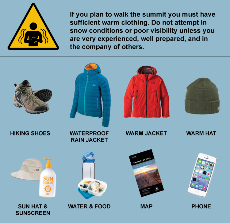
In winter, conditions might be calm at The Springs, but the wind at the summit can bring the temperature down significantly. For example, in 2024 bushwalkers had to be rescued from the summit in temperatures that felt like -21ºC and wind gusts that were above 100km/h. Do not attempt to walk to the summit in snow or poor visibility unless you are very experienced, well prepared, and in the company of others.

Find more information and essential tips for a safe walking experience:
Stay safe on the mountain
New tracks under construction
Waterworks Reserve Pipeline Track extension
Work on a new, family friendly track taking visitors from Waterworks Reserve past Gentle Annie Falls and on to the Pipeline Track starts in January 2025 and is expected to be completed in May.
Learn more on the project page.
Pipeline Track resurfacing work
Maintenance works on a section of Pipeline Track are scheduled to take place in May and June 2025.
More information will be available soon.
Future works
A Pipeline Track resurfacing project will begin in early 2025.
More information about this projects will be available soon.
Greater Hobart Trails
The Greater Hobart Trails website has information on the best walks and rides in greater Hobart. There are tracks and trails to suit everyone, from easy walks for the whole family to more challenging walks and rides for the more experienced.
It also provides a general description of each track, the level of difficulty, estimated time, facilities, suitability for wheelchairs and prams, whether dogs are allowed, an interactive map, photos and an elevation profile of the track.
Greater Hobart Trails